

How to reach us
Here is an excerpt from the Heidelberg city map which should help you to reach our institute from Heidelberg Main Station or motorway:
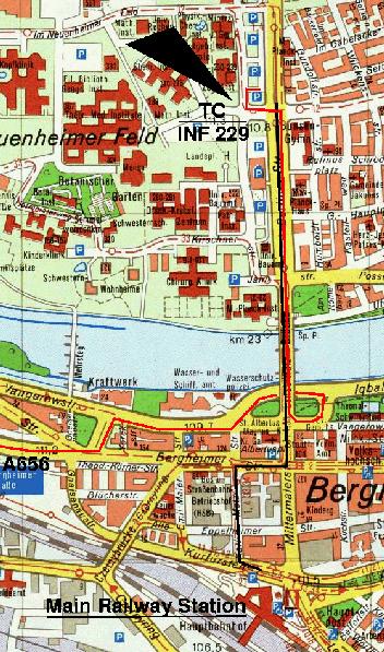
By train (black line on the map)
If you arrive at "Hauptbahnhof" (Main Station), you may
- have a 20 minutes' walk to the institute (see map)
- or take a taxi (5 minutes; leave the station hall through the east exit to get a taxi)
-
or take the tram: Take the north exit from the station hall and cross the tram rails for the right direction. Take either Tram 21 (direction "Technologiepark") or Tram 24 (direction "Handschuhsheim") and stop at "Bunsen-Gymnasium". This is the second stop after crossing the River Neckar. Cross the Berliner Straße and turn westwards towards the science campus Im Neuenheimer Feld (INF).
By car (red line on the map)
Arriving from the motorway Mannheim-Heidelberg, A656, turn left at its very end, at the first traffic lights. Turn right at the next junction. Follow this road (Vangerowstraße) until passing under a bridge after 400-500 m. Then turn right to access the bridge and cross the River Neckar (→ Berliner Straße). At the second traffic lights, turn left and look for one of the car parks on the map below; this map should also help you on your remaining short walk to the institute Im Neuenheimer Feld 229.
Here is a newer map showing also the building numbers:
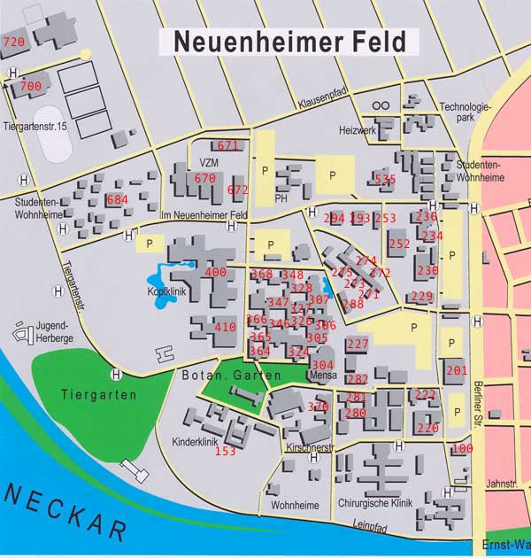
Having reached the campus: The large white building right at the entrance of the campus is INF 229. You will find the Theoretical Chemistry Group on the sixth floor of this building.
The entire Heidelberg city map is available at www.heidelberg.de.
Follow this link if you would like to see the weather forecast.